 | Main Catalog Catalog Direct Finders Direct Finders 3D-GEO DF 3D-GEO DF |  |
3D-GEO. New Direction Finding and Geolocation Solution

The newest device
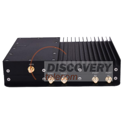
Vehicle 3D Direct Finder
|
Main characteristics
|
|||||||||||||||||||||||||||||||
New Advanced Direction Finding and Geolocation Solution
 |
3D-GEO is a state-of-the-art geolocation solution with advanced signal analysis capabilities. It can be used in applications such as surveillance and disaster recovery for locating active cell phones and thereby recovering users.
3D-GEO is designed for vehicular deployments and includes software for determining the exact location of a 2G, 3G or 4G cellular device.
3D-GEO narrows down the transmitter source location to a few meters, highly minimizing the search radius and positively impacting time-critical operations.
3D-GEO can be controlled over wired Ethernet or Wi-Fi through an easy-to-set-up and user-friendly Windows GUI that provides information such as power measurements, angle of arrival, power, as well as estimated source location overlaid on a map.
| 3D-GEO gives an estimate of both the azimuth and the elevation of a transmission source overlaid on a standard map. |  |
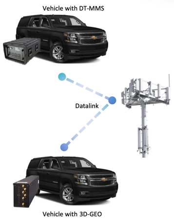
3D-GEO uses the movement of the vehicle and multiple readings from the phase array antennas to create a heat map that becomes more accurate as more information is gathered.
3D-GEO includes a 3G/LTE UE module for remote management of the unit. It is also possible to deploy multiple 3D-GEO units in different vehicles (connected to the cloud) to improve overall accuracy as well as reduce the operation time.
3D-GEO is a DF that have to be used with IMSI catchers or Active interception systems
3D-GEO is a DF that have to be used with IMSI catchers or Active interception systems
| File Title | Release Date | File Type | Size (mb) | Action |
|---|---|---|---|---|
| 3D-GEO. Direction Finding and Geolocation Solutions | 04-07-2020 | Documentation (pdf) | 0.64 MB |  download download |
| End User Certificate (EUC) to apply for purchase | 03-03-2021 | Documentation (pdf) | 0.09 MB |  download download |
To access this product file, get partner STE status
| File Title | Release Date | File Type | Size (mb) | Action |
|---|---|---|---|---|
| 3D-GEO. Direction Finding and Geolocation Solutions | 04-07-2020 | Documentation (pdf) | 0.64 MB |  download download |
| End User Certificate (EUC) to apply for purchase | 03-03-2021 | Documentation (pdf) | 0.09 MB |  download download |
To access this product file, get partner STE status
 |
 Additional Product Information Additional Product Information |
 |
Related products
You may also be interested in the following products


 Your basket


